
The Idea Strikes
So I was sitting there flipping through football highlight compilations yesterday when it suddenly hit me – wouldn’t it be wicked to create a proper geographic map showing all the Premier League clubs? Just like those old pirate treasure maps but for football grounds. Got me buzzing enough to abandon my cold noodles halfway.
Gathering Location Data
First thing’s first: needed stadium coordinates. Started manually searching “Old Trafford longitude latitude” like a right mug before realizing that ain’t practical. Scrambled together a Python script scraping stadium addresses from league tables, then plugged them into geocoding tools. Nearly cried when it kept placing Manchester City’s Etihad Stadium in bloody Manchester, New Hampshire across the pond.
The Mapping Shambles
Thought plotting would be straightforward after getting coordinates. How wrong was I? Tried three different mapping libraries:
- First one displayed all London clubs floating in the Thames
- Second showed Newcastle’s St. James’ Park hovering over North Sea oil rigs
- Third somehow managed to put half the teams in France
My kitchen table got buried under empty energy drink cans real quick during this phase.
Colors Went Tits Up
Wanted to make each club’s dot match their kit colours. Seemed simple enough – red for Liverpool, blue for Chelsea etc. Turned into absolute carnage when:
- Couldn’t agree with myself whether Arsenal should be red or white
- West Ham’s claret looked identical to Aston Villa’s under dim lighting
- Accidentally made Nottingham Forest’s marker piss-yellow instead of proper red
Spent two hours arguing with color picker tools like they owed me money.
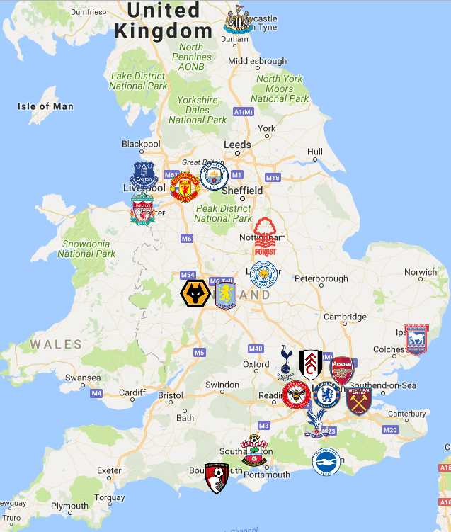
Printing Disaster
Finally had something decent on screen. Thought “brilliant, I’ll print this beauty and stick it on my wall”. Printer jammed twice then spat out something resembling a toddler’s finger painting. Brentford’s dot ended up bigger than London itself, while Luton Town completely vanished near the paper edge.
What I Ended Up With
After all that kerfuffle, here’s what actually worked in the end:
- Ditched the printer for a screenshot
- Made all markers same generic blue to avoid color debates
- Added little football icons instead of dots
- Zoomed out enough that Wales didn’t feel offended by Bournemouth sitting on their border
Honestly looks half-decent now. Might frame it if I can find where my cat hid the printout.
Why This Reminded Me of My Brother
This whole mess took me back to when my brother tried making a “beer map of London pubs” last summer. Got so plastered during “research” that his final version placed Buckingham Palace between two dodgy Wetherspoons. Had to bail him out at 3am when he argued with a bouncer about “cartographic liberties”. Reckon he’d appreciate this Premier League map – if he ever sobers up enough to see straight, that is.